


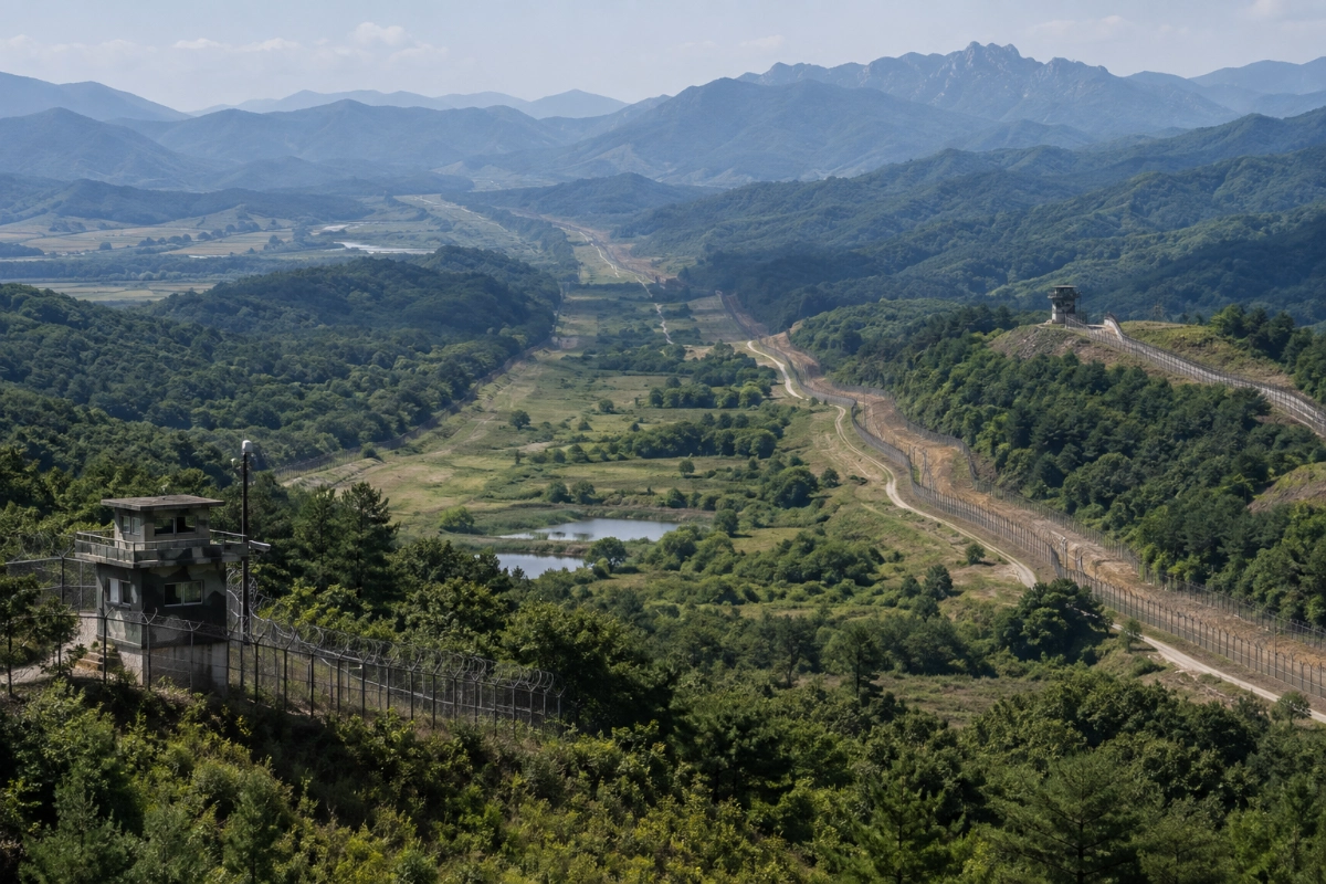
The North Korea South Korea border facts reveal why the Korean Demilitarized Zone (DMZ) is one of the most heavily guarded and closely watched borders in the world. Rather than being a conventional international border, it is a military buffer created after the Korean War.
The DMZ separates North Korea and South Korea along a Military Demarcation Line (MDL). It is approximately 4 kilometers wide and runs roughly 241 kilometers across the Korean Peninsula. The two sides each withdrew their forces about 2 kilometers from the MDL under the 1953 Korean Armistice Agreement.
But there is an important distinction: the DMZ itself is not simply an empty strip of land. Guard posts, surveillance systems, military infrastructure and explosive hazards exist around the wider border area, while access to the DMZ is strictly controlled.
Table of Contents
What Is the Border Between North Korea and South Korea?
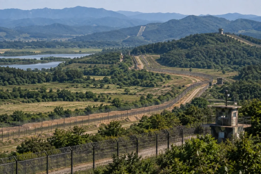
The principal land separation is the Military Demarcation Line, established under the 1953 Armistice Agreement.
The area surrounding it is known as the Demilitarized Zone, or DMZ. The armistice created the DMZ as a buffer designed to keep opposing military forces apart and reduce the possibility of renewed fighting.
The DMZ is about 4 kilometers wide. Both sides were required to withdraw approximately 2 kilometers from the Military Demarcation Line, creating a buffer between their forces.
So, when people talk about the “North Korea-South Korea border,” they are often referring to the wider DMZ and the Military Demarcation Line within it.
1. The Korean War Did Not End With a Peace Treaty
One of the most important North Korea South Korea border facts is the legal and historical status of the Korean War.
On July 27, 1953, the Korean Armistice Agreement brought the fighting to a halt. However, it was a military armistice rather than a permanent peace treaty. The United Nations Command states that no formal peace treaty was subsequently signed, meaning the peninsula technically remains in a state of war.
The armistice was intended to stop open hostilities and create conditions for a later peaceful settlement. The agreement established the Military Demarcation Line and DMZ as part of that arrangement.
This is why the border remains so heavily secured more than seven decades after the fighting stopped.
2. The DMZ Is About 4 Kilometers Wide
The DMZ is not a narrow line separating the two countries.
Under the armistice, the opposing forces withdrew 2 kilometers on either side of the Military Demarcation Line. Together, those areas form a buffer approximately 4 kilometers wide. The zone stretches about 241 kilometers across the peninsula.
Its exact landscape varies considerably, including forests, hills, rivers and other terrain.
Despite its name, the DMZ should not be interpreted as meaning that there is absolutely no military activity or security infrastructure anywhere in the broader border region.
3. The Military Demarcation Line Is the Key Separation Line
The Military Demarcation Line (MDL) is the actual line established by the armistice.
The 1953 agreement prohibits people from crossing the MDL without authorization. It also establishes restrictions on activities within the DMZ.
This distinction matters because the MDL and DMZ are not the same thing:
- MDL: The military boundary line.
- DMZ: The approximately 4-kilometer-wide buffer surrounding the MDL.
- Border security areas: Heavily monitored areas outside and around the DMZ.
Understanding these terms makes many reports about incidents along the Korean border easier to follow.
4. Landmines Are a Major Hazard
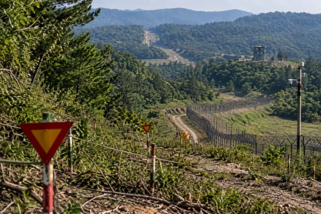
Landmines are one of the most serious physical dangers associated with the DMZ.
A U.S. Army publication has estimated that the southern portion of the DMZ alone contains more than one million landmines, along with unexploded ordnance. It also notes that mine locations may not always be completely documented and that weather can contribute to mine movement.
Because of this danger, the claim sometimes repeated online that there are exactly “2 million mines” throughout the entire border should not be presented as a precise verified figure without qualification.
The danger is not merely historical. In September 2026, three South Korean military officers were injured by an explosion while conducting an operation inside the DMZ. South Korean authorities had not immediately established the cause, although reports raised the possibility of a mine.
This recent incident demonstrates that explosive hazards remain a real concern in the area.
5. People Cannot Simply Walk Across the Border
The North Korea South Korea border is not a place where civilians can freely approach the dividing line and cross into the other country.
The 1953 Armistice Agreement states that people cannot cross the Military Demarcation Line without authorization. Entry into the DMZ itself is also subject to strict restrictions.
The security arrangements include military personnel, observation posts, controlled access routes and other surveillance measures.
There have nevertheless been accidental or unauthorized crossings.
For example, in June 2024, South Korean forces fired warning shots after North Korean soldiers crossed approximately 20 meters over the Military Demarcation Line. South Korean authorities assessed the crossing as apparently unintentional.
A separate incident occurred in 2023 when a U.S. national on a tour in the Joint Security Area crossed the Military Demarcation Line into North Korea without authorization.
These incidents illustrate how seriously even brief crossings are treated.
6. Panmunjom and the Joint Security Area Are Special Locations
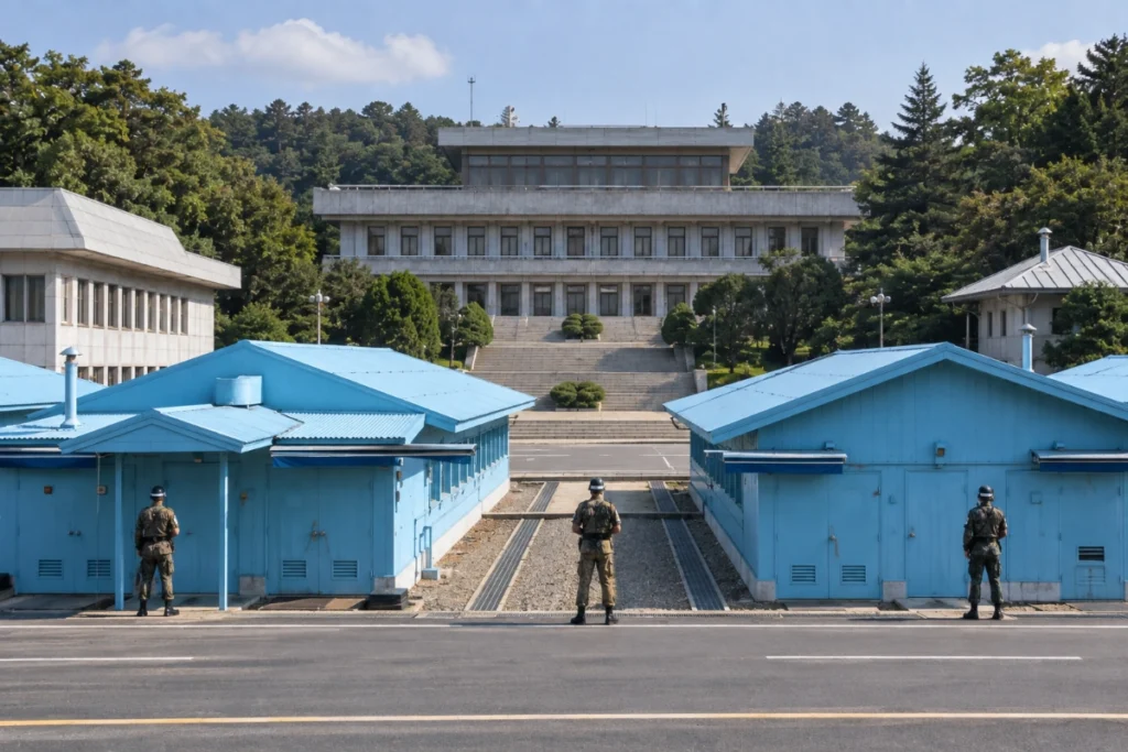
One of the best-known locations along the DMZ is Panmunjom, associated with the Joint Security Area (JSA).
The JSA has historically been a place where representatives from North Korea, South Korea and the United Nations Command have met for military and diplomatic discussions.
The United Nations Command Security Battalion continues to secure the JSA and supports the implementation of the Armistice Agreement.
The area has also witnessed serious confrontations.
In August 1976, U.S. Army officers were killed during an incident involving North Korean soldiers while a tree was being trimmed in the JSA. The incident was followed by Operation Paul Bunyan, during which the tree was cut down under a major show of force by U.S. and South Korean forces.
7. The Border Has Changed Significantly in Recent Years
The border is not frozen in exactly the same physical condition it had decades ago.
North Korea has undertaken construction and defensive work near the DMZ. In 2024, North Korea demolished sections of inter-Korean roads and railway connections on its side of the border.
Satellite imagery subsequently showed the construction of trenches near some former transportation routes.
More recently, the United Nations Command reported in June 2026 that North Korean activities including fencing and road repairs were being monitored under the armistice framework. The UNC said such construction north of the MDL does not automatically constitute an armistice violation.
This is an important distinction: construction near the border does not automatically mean that the armistice has been violated.
8. The DMZ Is Also an Important Wildlife Area
An unexpected aspect of the Korean DMZ is its environment.
Because ordinary civilian development and movement have been severely restricted for decades, portions of the area have become important habitat for wildlife.
The absence of normal urban development has allowed forests and other natural environments to persist in areas affected by the long military standoff.
However, the presence of mines and unexploded ordnance means that the area cannot simply be treated as an ordinary nature reserve.
The DMZ therefore represents an unusual combination of military history, restricted human access and relatively undisturbed ecosystems.
9. The Border Remains Heavily Monitored
The DMZ is often described as one of the world’s most heavily militarized borders.
Although the DMZ was created as a demilitarized buffer, military forces remain positioned on both sides outside the zone, and the border is subject to surveillance and military readiness.
In September 2026, United Nations Command officials visited frontline guard posts to review the operational situation and recent North Korean military activity near the Military Demarcation Line.
This continuing monitoring reflects the unusual status of the Korean Peninsula: active hostilities have been suspended for decades, but no permanent peace treaty replaced the armistice.
10. Why Is the North Korea South Korea Border So Dangerous?
The danger comes from several factors operating together rather than from one single feature.
Military forces
Large military forces remain positioned on both sides of the peninsula, with the border area closely monitored.
Landmines and unexploded ordnance
Decades-old mines and unexploded weapons remain a serious hazard. Some minefields are difficult to document or clear safely.
Accidental crossings
The Military Demarcation Line is strictly controlled, and even accidental crossings can trigger military responses.
Political and military tensions
The two countries have experienced repeated periods of tension, military incidents and changes in their relationship.
Difficult terrain
Forests, hills, fog and vegetation can make observation and movement more complicated. United Nations Command officials noted in September 2026 that dense foliage and frequent fog can create challenges for security operations.
North Korea South Korea Border Facts at a Glance
| Fact | Verified information |
|---|---|
| Main dividing line | Military Demarcation Line (MDL) |
| Buffer zone | Korean Demilitarized Zone (DMZ) |
| DMZ width | Approximately 4 km |
| DMZ length | Approximately 241 km |
| DMZ established | 1953 |
| Armistice date | July 27, 1953 |
| Peace treaty | No formal peace treaty was signed |
| Famous location | Panmunjom / Joint Security Area |
| Major hazard | Landmines and unexploded ordnance |
| Civilian access | Highly restricted |
| Current status | Remains a heavily monitored military buffer |
The dimensions and armistice details above come from the 1953 agreement and United Nations Command documentation.
Frequently Asked Questions
Is the border between North Korea and South Korea called the DMZ?
The area is called the Demilitarized Zone (DMZ). The actual dividing line inside the DMZ is the Military Demarcation Line (MDL).
How wide is the Korean DMZ?
The DMZ was established as approximately 4 kilometers wide, with forces withdrawing about 2 kilometers on each side of the Military Demarcation Line.
Are North Korea and South Korea technically still at war?
The Korean War was halted by the 1953 Armistice Agreement, but no formal peace treaty was subsequently signed. The United Nations Command therefore describes the Korean Peninsula as technically remaining in a state of war.
Can tourists visit the Korean DMZ?
Some areas associated with the DMZ can be visited under controlled tourism or official programs, but access is restricted and conditions can change according to security circumstances. The JSA is particularly sensitive and operates under strict security arrangements.
Does the DMZ contain landmines?
Yes. Landmines and unexploded ordnance remain major hazards in and around parts of the DMZ. A U.S. Army publication has estimated more than one million mines in the southern portion of the DMZ alone.
What is Panmunjom?
Panmunjom is the area associated with the Joint Security Area, a historically important location for military talks and interactions between the two sides.
Why can’t people simply cross from South Korea into North Korea?
Crossing the Military Demarcation Line without authorization is prohibited under the armistice framework and is extremely dangerous because of military security measures and explosive hazards.
Is the North Korea-South Korea border still dangerous today?
Yes. The area remains heavily monitored and militarized, and explosive hazards continue to pose risks. In September 2026, three South Korean military officers were injured by an explosion inside the DMZ during an operation. The precise cause was initially unclear.
Conclusion
The North Korea South Korea border is much more than a line on a map. It is a highly controlled military buffer created by the 1953 Armistice Agreement after the Korean War.
The approximately 4-kilometer-wide DMZ separates the opposing forces, while the Military Demarcation Line marks the central division. Landmines, surveillance, military infrastructure and strict access controls make the region exceptionally sensitive.
At the same time, the DMZ has become an unusual environmental zone because human activity has been restricted for decades.
Perhaps the most important fact is that the 1953 agreement stopped the fighting but did not create a permanent peace treaty. More than seven decades later, the armistice continues to form the framework governing the military separation between North and South Korea.

